Explore California Water Histories in Documents and Data
Here you will find information and updates about the Claremont Colleges Library’s ongoing mission to make the data in our California Water Documents collection accessible.
As part of the Collections as Data Project’s second (2020) cohort, we are working on improving the computational accessibility of the tables, charts, and maps that are part of this collection. We are also engaging community partners and other research communities to include the perspectives of the Native Californian peoples often rendered invisible after decades of settler water displacement.
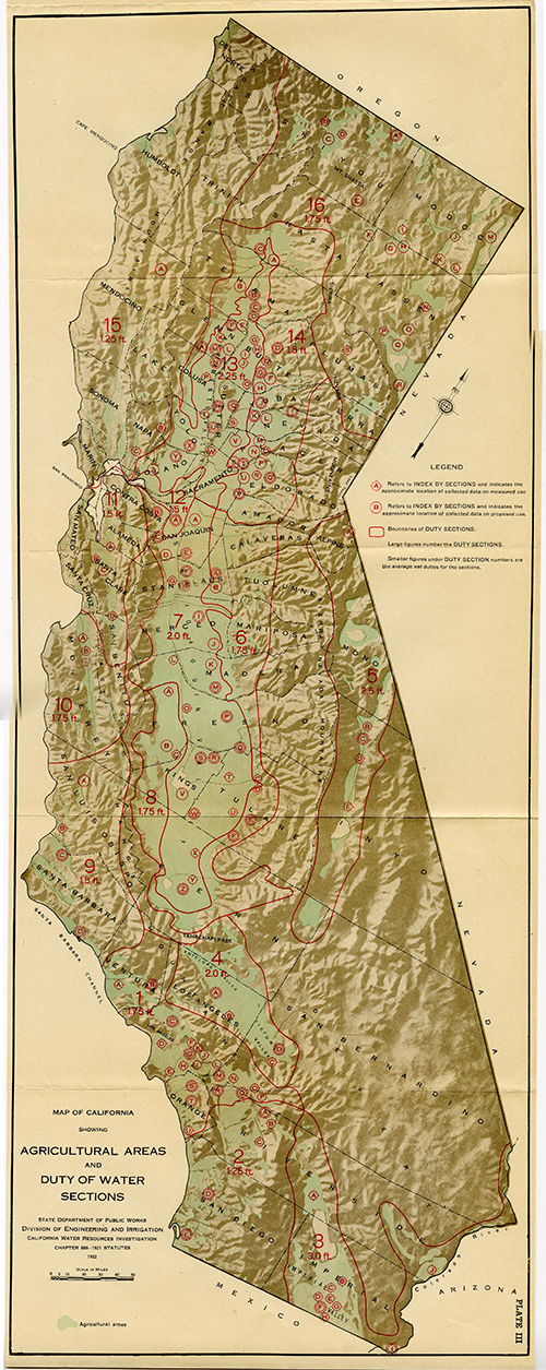
The collection, which consists of over 13,000 digital files, is filled with charts, maps, graphs, describing late 19th and early 20th century California water history. The mixed archival materials include journals, ledgers, correspondence, field notes, and maps documenting the history of water use in Southern California. This rich collection has the potential to surface the histories of the earliest inhabitants of the west (including the Tongva, Serrano, Paiute, and Cahuilla peoples) who utilized local waterways to those who exploited the First People’s knowledge and labor to build the region’s modern agriculture and urban economy.
Watch the 2021 Western Water Symposium recording (YouTube)Objectives of the Project
The Bending Water project team is currently assessing improvements to the digitized collection aimed at the following objectives:
- Make the textual data computationally accessible and searchable through the application OCR software and tabular data formats where appropriate
- Update the metadata to reflect place names for Indigenous communities referenced in the collection
- Develop a GIS application to display geographic data from the maps
- Create a glossary with water terminology inclusive of several languages and disciplinary perspectives
We hope that these steps can help scholars and Native communities answer questions about California’s environmental history, the history of land ownership and colonization of Indigenous lands, and California’s agriculture.