A Note About Maps:
We include some maps here from our Native neighbors and researchers studying Indigenous history.
It is worth keeping in mind that maps in historical collections are usually artifacts of a settler perspective. They break the world up into pieces labeled with very specific designations based on politics and colonial ideas of ownership.
Native relationships to the land and its waterways were quite different, and cannot always be fully captured in maps, but we find these examples to be useful and enlightening.
[iframe url=”https://native-land.ca/api/embed/embed.html?maps=territories” height=”375px” width=”100%”][/iframe]
This map is from Native Land Digital, a registered Canadian not-for-profit organization that is working on a collaborative mapping project of Indigenous lands, languages, and treaties around the globe. The authors caution that the map is not to be used as an academic or legal resource. Sourcing data on Indigenous territories is a delicate process and the map should be used with an understanding that areas may be incorrect according to local nations and individual interpretation. The Native Land team is in a constant state of research and adjustment to the map in effort to remain as accurate as possible, however errors may exist.
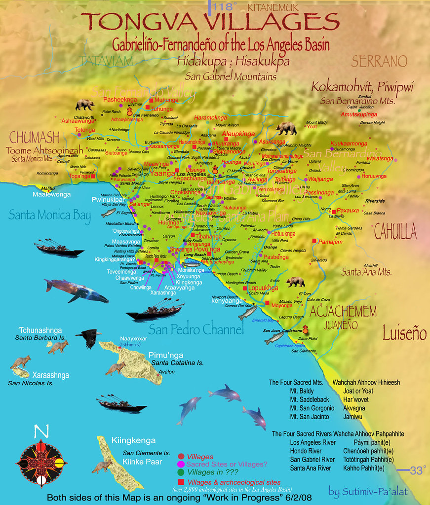
A ongoing project of the Tongva community showing locations of Tongva villages and sacred sites.