Today’s example of data comes in the form of a press release from 1930. The majority of the page is a map of the United States. Three world famous engineers who recommend the Metropolitan Aqueduct route are featured within the map next to the city where they come from. This item in the California Water Documents collection is a prime example of how design, text, and data merge together to provide succinct information. First, we will take a look at the map
Press Release Map
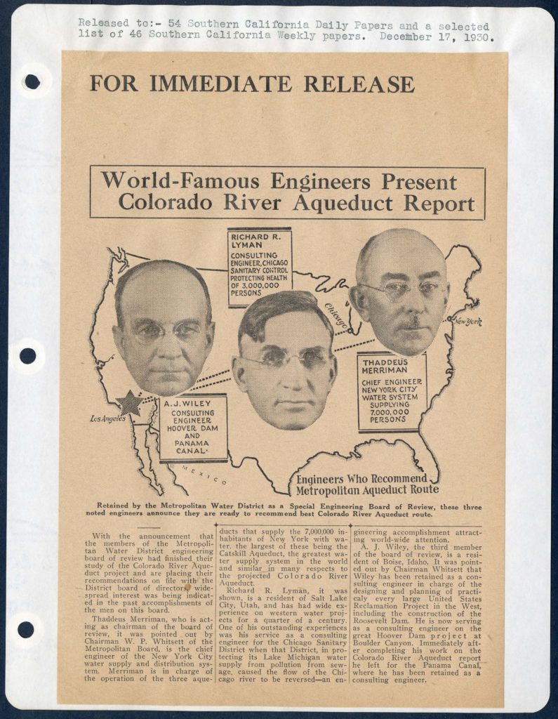
This press release comes from 1930, three years before construction on the aqueduct began. The map is an outline of the United States, but the unique aspect of this map is Chicago and New York City are connected to Los Angeles. The map presents a simple but effective representation of the aqueduct engineering team. The following section takes a deeper looking into the engineers who imagined the aqueduct path.
The Engineers
Thaddeus Merriman (1876-1939) son of well-known civil engineer Mansfield Merriman graduated from Lehigh University in 1897. He was an editor on the American Civil Engineers’ Handbook and contributed heavily to dissertations and reports on hydraulics. His experience as chief engineer of the New York City water supply and distribution system primed him for the role of chairman to the Metropolitan Aqueduct review board.
Richard R. Lyman (1870-1963) previously served as an engineering consultant on the Chicago Sanitary District which kept sewage from contaminating Lake Michigan. He also has experience with Western territories since he moved from Salt Lake City, Utah to study at the University of Michigan. He inevitably brings sanitation expertise to the project.
A. J. Wiley is a more difficult engineer to uncover facts about. He is mentioned in articles about the Roosevelt Dam, Hoover Dam, and the Panama Canal, but I can only uncover that he was from Boise, Idaho. His experience in Panama seems to be the only international job mentioned by the article. This begs the question as to what international acclaim these engineers earned prior to the Metropolitan Aqueduct plans.
Conclusion
The data conveyed by this map is nothing spectacular, but the simplicity of the design suits the message. The early photoshop quality of the heads of the engineers fixed over the map is appealing to the casual reader. The dashed lines all connecting to Los Angeles convey the national influence on the Metropolitan Aqueduct planning. This is a clever and interesting map held by the Claremont Water Documents collection and there are multiple insights to be made from the information therein.